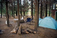
 The camp site (thanks for the tent Gareth).
Matroosberg Hiking Trail, Matroosberg Private Reserve
Location : Ceres, Western Cape, South Africa
Distance : 13km
Duration : 8 hours (1 day)
Difficulty : moderate
Present : Deneille Jacobs, Rudolf du Toit
The Matroosberg Private Reserve is on the farm Erfdeel, 35km from Ceres towards Touwsrivier. The Matroosberg peak is the highest point above sea level in the Western Cape at 2249m. The area is usually covered with snow during winter and the reserve features two ski slopes. The peak offers great views over the Hex River Valley, DuToitskloof, Cederberg and Witzenberg mountains. There is also a 4x4 trail which leads all the way to the peak. The Groothoek Gorge is a spectacular gorge you will pass along the trail.
We started the hike at 08:30.
It was a chilly misty morning, and I was able to catch the sun gleaming through the pine trees. We started at the camp site in a small pine forest. We decided to walk the extra 2km to the start of the hiking trail. A good idea, because the gravel road that lead to the parking area where the trail started was not suitable for an ordinary car at the time.
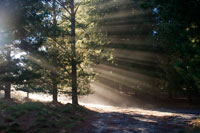 Sun shining through the misty trees.
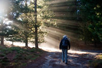 Deneille
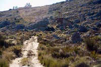
 Deneille on the jeep track.
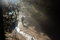
About half way towards the parking area we passed the first ski hut. The trail leads into a wide gorge and follows the river. We only saw a few patches of snow at that point.
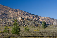 The surroundings.
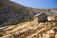
 This is the first ski hut.
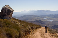
 A look back to where we started.
By the time you reach the goat shed, you are at the first ski slope. There were a couple of guys on the slope. They mentioned that a month ago (August) the snow was a lot thicker. Still, there was enough snow to have some fun. The ski slope is privately owned and features a diesel powered system to hoist you up to the top of the slope.
 The goat shed.
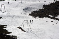 The first ski slope.
 The first ski slope.
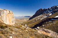
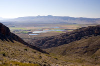
After the first ski slope, we joined the 4x4 gravel road. A short climb lead us to the spectacular Groothoek gorge (left photo below). There was quite a bit of snow on the mountain to the left of the gorge. We then continued towards Matroosberg peak on the gravel road.
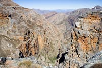 Huge gorge.
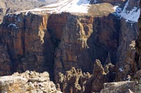
 Snowy mountain.
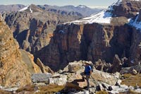
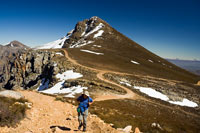 The 4x4 track towards the peak.
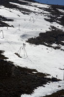
Just over the ridge, we reached the second ski slope, also fitted with a hoist system. The second slope was deserted, so we decided to have some fun.
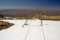 The second ski slope.
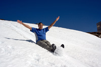
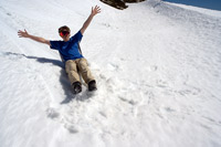 Me, having some fun in the snow.
 Deneille, having some fun in the snow.
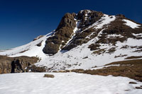
We finally reached the top at about 13:00 where we were met with breathtaking views. Below you can see a panoramic photo of the Groothoek gorge area.
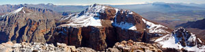 This is a panoramic view from the top of the peak.
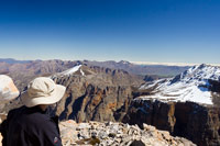 Deneille enjoying the view.
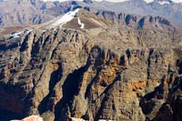
The rocky cliffs are really something. The photo below on the right is the actual peak of Matroosberg, standing 2249m above sea level - the highest peak in the Western Cape.
 Impressive rock face.
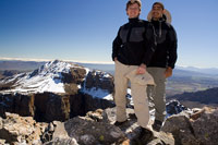 Deneille and I.
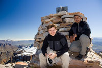 Deneille and I at the peak.
We had lunch and started the descent. A couple of other angles of Groothoek gorge below...
 Deneille at the gorge.
 Another view of the rock face.
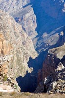 The gorge.
We decided to take the 4x4 gravel road back down towards the campsite. As with most descents, this resulted in pretty sore joints and feet.
 The 4x4 track back down.
 The view on the way down.
The Matroosberg hiking trail was really enjoyable. I think it can get tricky if the snow is covering the path, as there are no proper markings. Definitely a trail that I will do again.