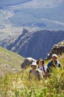
 This is the start of the trail.
Swartboskloof Hiking Trail, Jonkershoek Nature Reserve
Location : Stellenbosch, Western Cape, South Africa
Distance : 18.4km
Duration : 8 hours (1 day)
Difficulty : moderate-strenuous
Present : Deneille Jacobs, Rudolf du Toit, William Sandenbergh, Gareth Harding
After purchasing a permit at the office gate (R20 per person in 2007) and signing in, you either have the option to walk or to drive the gravel road to the parking area where the trail starts. The gravel road follows a circular route for appproximately 10km. We were pressed for time, so we decided to drive the 4km to the parking area by car. The road was in good condition (no 4WD vehicle required).
We started the hike at 09:00.
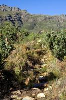
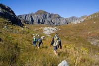
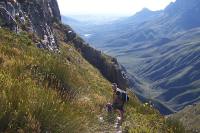
The path was very wet and overgrown after the heavy winter rainfall, with water streams running down the footpath in some areas. On numerous occasions we could not see where we were stepping due to the vegetation. The fynbos was lush and the proteas were exceptionally tall (as you can see in the center image below). The initial 5km is all uphill.
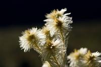 Lots of different fynbos species.
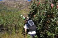 Huge proteas.
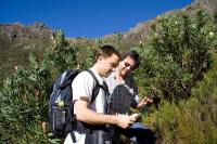 Gareth & William checking the map.
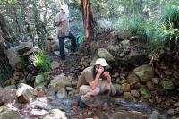
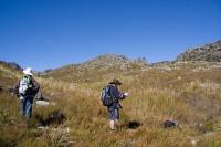
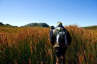
The trail kept us interested. There were some dense areas and many, many streams. Lots of photo opportunities.
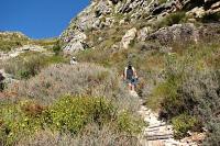
 Some areas are quite dense and overgrown.
 Me taking a photo and William having another look at the map.
 Lots of streams after the winter rain.
Some of the streams were a bit tricky to get across, but nothing serious.
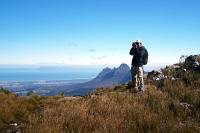
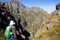
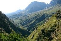
 The view back to the start of the trail.
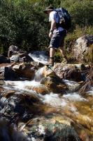 Some of the streams were a bit tricky to cross.
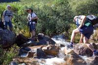 Some of the streams were a bit tricky to cross.
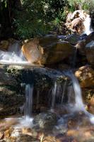
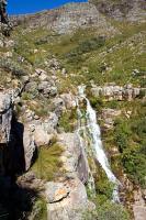
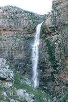
Almost at the top we walked past a pretty big waterfall (first photo below). If you look closely, you can see Gareth standing on the left of the waterfall towards the top. It is a good idea to look behind you occasionally and enjoy the view.
 Lots of waterfalls after the winter rain.
 The view back to the start of the trail.
 The view back to the start of the trail.
It is always nice to see some wildlife when you are out hiking. On this day we saw quite a number of "Klipspringer" (biological name: Oreotragus oreotragus).
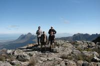
 William, Gareth & Deneille.
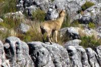 Klipspringer
 The view back to the start of the trail.
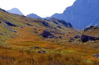
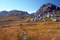
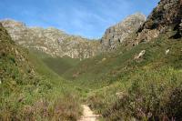
We finally reached the top at about 12:40. Interesting vegetation and rock formations on the plateau. With no route markers, we had another look at the map. The map indicated that we had to go East. By chance we decided to go West and had a look over the ridge.
 At the top, having another look at the map.
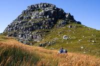
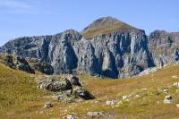 Interesting rock formations.
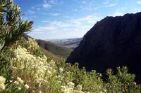
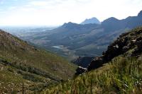
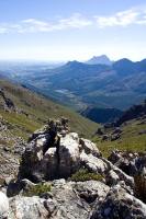
WHAT A VIEW! There was no indication of this viewpoint on the map, or on the trail! We almost missed it!
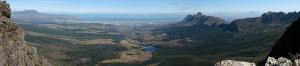 The view we almost missed.
From here we could see Table Mountain, the whole of False Bay, Somerset West, Strand and Gordon's Bay. We had lunch there and enjoyed the view.
 Me and Deneille.
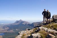
 The guys enjoying the view.
 Me at the view.
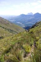
After lunch, we started walking East at about 13:30PM. Plant species differed somewhat on the plateau. Tall reeds and many small, colourful flowers.
 Towards Guardian Peak.
 Overgrown.
 Colourful vegetation.
We walked past a gorge (called Boegoekloof I think). In the photo below on the right you can see how wet the trail was.
 Impressive gorge.
 Sneaky view towards Gordon's Bay.
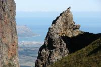
 Interesting hill.
After a nice walk on the plateau, we started the overgrown, steep, rocky descent down Kurktrekker. We reached Kurktrekker at about 15:00.
 Interesting hill.
 About to head down Kurktrekker.
 Heading down Kurktrekker.
After about an hour, most of the pounding descent was over when we reached the "second waterfall", as indicated on our map.
 Another view down Kurktrekker.
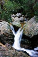
 The "Second Waterfall".
 Stream at the "Second Waterfall".
Later we also passed the "first waterfall", but it was not as impressive as the "second waterfall".
 Looking back towards Kurktrekker.
The trail finished back at the gravel road, but about 2km ahead of where we originally parked. We walked back to the car and completed the circular route. We were back at the Jonkershoek gate by about 17:30. Close call, as the gate closes at 18:00.
In retrospect, it was an enjoyable trail. Pity that the path was as overgrown at the time, but then I guess we would not have seen so many water streams. The descent down Kurtrekker was the least enjoyable. The authorities need to spend some time fixing the steps and clearing the vegetation.